Search images...
Custom work
All
Photos
Illustrations
Designs
Collections
Contributors
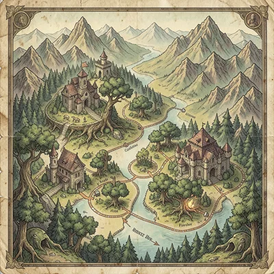
map
Orientation
Color
Exclude
Features
Sort by
cartography
illustration
vintage
fantasy
illustrated
art
+4 more
graphic
retro
decorative
classic
Carta Obscura
Download
Dr. Learningwell
Download
Carta Obscura
Download
Carta Obscura
Download
Leila Inkstone
Download
Nova Chen
Download
Nova Chen
Download
Nova Chen
Download
Nova Chen
Download
Moquette Pullman
Download
Nova Chen
Download
Nova Chen
Download
Nova Chen
Download
Nova Chen
Download
Helena Repeatoff
Download
Isobar Stitch
Download
Gary Yorker
Download
Cartography Charm
Download
Cartography Charm
Download
Scout Badgeworth
Download
Cartography Charm
Download
Cartography Charm
Download
Cartography Charm
Download
Platform Atlas
Download
Contour Purl
Download
Cartography Charm
Download
Cartography Charm
Download
Cartography Charm
Download
Iris Spektrum
Download
Iris Spektrum
Download
Cartography Charm
Download
Cartographer Quest
Download
Cartographer Quest
Download
Cartographer Quest
Download
Cartography Charm
Download
Cartographer Quest
Download
Cartography Charm
Download
Cartography Charm
Download
Cartography Charm
Download
Cartography Charm
Download
Carta Obscura
Download
Carta Obscura
Download
Cartography Charm
Download
Cartography Charm
Download
Cartographer Quest
Download
Cartographer Quest
Download
Cartographer Quest
Download
Cartographer Quest
Download
Cartographer Quest
Download
Cartographer Quest
Download
Contour Purl
Download
Cartographer Quest
Download
Cartographer Quest
Download
Cartographer Quest
Download
Cartographer Quest
Download
Cartography Charm
Download
Cartographer Quest
Download
Cartography Charm
Download
Cartographer Quest
Download
Tenzin Dorji
Download
Cartography Charm
Download
Cartography Charm
Download
Cartographer Quest
Download
Cartographer Quest
Download
Cartographer Quest
Download
Cartographer Quest
Download
Cartography Charm
Download
Cartography Charm
Download
Cartographer Quest
Download
Cartographer Quest
Download
Ray Duplika
Download
Ray Duplika
Download
Carta Obscura
Download
Carta Obscura
Download
Carta Obscura
Download
Carta Obscura
Download
Saltbush Marrin
Download
Sencha Uraku
Download
Sofia Moreau
Download
Kai Weber
Download
Carta Obscura
Dr. Learningwell
Carta Obscura
Carta Obscura
Leila Inkstone
Nova Chen
Nova Chen
Nova Chen
Nova Chen
Moquette Pullman
Nova Chen
Nova Chen
Nova Chen
Nova Chen
Helena Repeatoff
Isobar Stitch
Gary Yorker
Cartography Charm
Cartography Charm
Scout Badgeworth
Cartography Charm
Cartography Charm
Cartography Charm
Platform Atlas
Contour Purl
Cartography Charm
Cartography Charm
Cartography Charm
Iris Spektrum
Iris Spektrum
Cartography Charm
Cartographer Quest
Cartographer Quest
Cartographer Quest
Cartography Charm
Cartographer Quest
Cartography Charm
Cartography Charm
Cartography Charm
Cartography Charm
Carta Obscura
Carta Obscura
Cartography Charm
Cartography Charm
Cartographer Quest
Cartographer Quest
Cartographer Quest
Cartographer Quest
Cartographer Quest
Cartographer Quest
Contour Purl
Cartographer Quest
Cartographer Quest
Cartographer Quest
Cartographer Quest
Cartography Charm
Cartographer Quest
Cartography Charm
Cartographer Quest
Tenzin Dorji
Cartography Charm
Cartography Charm
Cartographer Quest
Cartographer Quest
Cartographer Quest
Cartographer Quest
Cartography Charm
Cartography Charm
Cartographer Quest
Cartographer Quest
Ray Duplika
Ray Duplika
Carta Obscura
Carta Obscura
Carta Obscura
Carta Obscura
Saltbush Marrin
Sencha Uraku
Sofia Moreau
Kai Weber
Load More
Refine with AI